


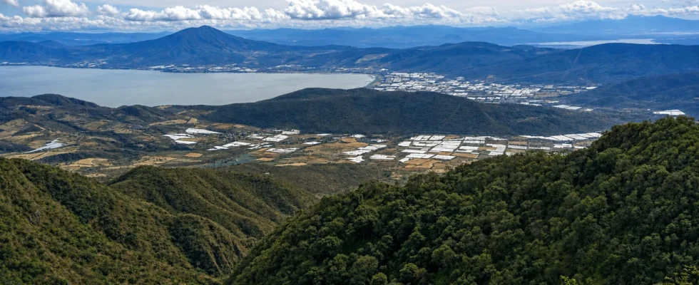
Guadalajara is surrounded by nature that is closer than it seems: pine and oak forests, a 600-meter (1,970 ft) canyon, volcanoes topping 2,900 meters (9,500 ft) above sea level, waterfalls, stone spheres and the mountains along the Lake Chapala shore, almost all within three hours. This is the most complete guide to the best places for hiking near Guadalajara: 16 areas and more than 30 named trails for every level, organized by zone, each with its trailhead, distance, elevation gain, difficulty, what you will see, a practical tip and a link to the track on AllTrails or Wikiloc so you can download it for offline use before you go.
🥾 Before you go: Best season: October to May (dry season); during the rains (Jun-Sep) the waterfalls carry more water but the canyon trails get slippery. Bring: hiking shoes, 1.5-2 L of water, a cap, sunscreen, snacks, a rain poncho and a charged phone with the route’s offline map (AllTrails or Wikiloc). Safety: start early, tell someone your plan, do not hike alone on long routes and get back before dark. How to use this guide: for each trail you will see 📍 the area and travel time from the city, the difficulty and a 🗺️ link to the actual track.
Trails in and around the city
You do not need to drive far for a real hike. These areas are inside Guadalajara and Zapopan, and several work as a “gym” before more serious routes. Note a detail many guides ignore: places like El Diente or La Primavera are not a single trail but protected areas with several named paths. Here we list them separately.
1. Barranca de Huentitán (Barranca de Oblatos)

The city’s most iconic hike starts at the Mirador de la Barranca, at the end of Calzada Independencia (Dr. Atl area). You descend into a canyon about 600 meters (1,970 ft) deep carved by the Río Grande de Santiago. The classic route is the “ruta de las curvas” (route of the curves): a cobblestone path with 64 numbered switchbacks down to the old Puente de Arcediano bridge, about 10 km (6.2 miles) round trip with ~520 m (1,700 ft) of elevation gain. Going down is easy; the climb back up is the hard part. For a longer outing there is the Circuito Grande de la Barranca, which links lookouts and follows the canyon rim. 📍 In the city · Difficulty: strenuous · ~4 hours · Free. Tip: start down very early and carry 2-3 L of water; the climb back at midday is brutal. 🗺️ Circuito Grande track on AllTrails.
2. El Diente and Bosque Nixticuil (BENSEDI)
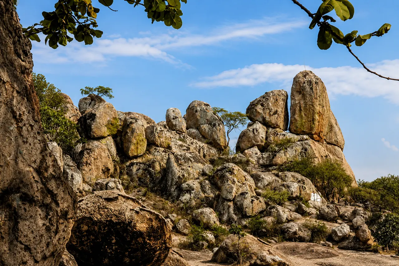
In northern Zapopan, the Bosque El Nixticuil-San Esteban-El Diente Protected Natural Area (BENSEDI) protects 1,591 hectares (3,930 acres) of oak forest and is perhaps the area with the most trails per hectare in the whole city. It is the region’s bouldering mecca and a huge park for walking, running or biking. These are the trails people actually use, and almost no one names them:
- El Diente: the classic out-and-back to the granite crags (1,760 m / 5,775 ft), ~2.9 km (1.8 miles), moderate, +118 m. Ideal for beginners and for watching the climbers. 🗺️ Track on AllTrails.
- Circuito Bosque El Nixticuil: an easy, shady loop of ~5.1 km (3.2 miles), +112 m, perfect for a weekday run or walk. 🗺️ Track on AllTrails.
- Cerro San Esteban: a fuller loop of ~9 km (5.6 miles) that climbs the hill of the same name, with good views. 🗺️ Track on AllTrails.
- Piedra el Fistol – El Diente: an out-and-back of ~8 km (5 miles) linking several rock formations; a step up in distance. 🗺️ Track on AllTrails.
📍 ~30 min · Difficulty: very easy to moderate · Free on foot (there is a fee if you drive in). Tip: enter early via Calle José María Morelos to enjoy the shade of the oak forest and combine hiking with climbing. 🗺️ All BENSEDI trails on AllTrails.
3. Trail Bugambilias (Cerro el Tajo)
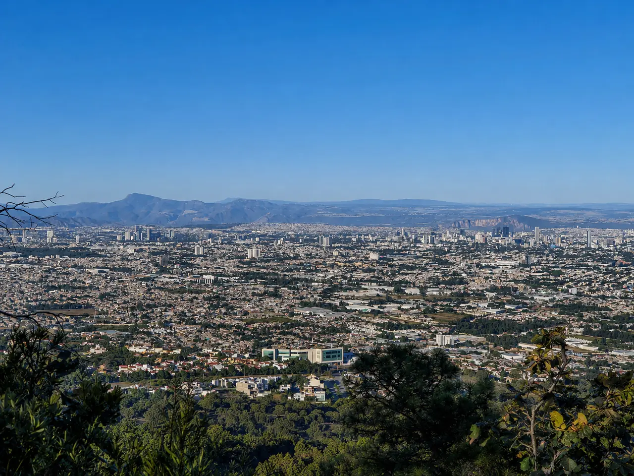
A few kilometers from southern Avenida López Mateos, in the Cerro el Tajo Environmental Recovery Zone, this well-marked trail is a favorite for sunrise training. It climbs through pine and oak forest with a spectacular view over the whole city and gains about +365 m (1,200 ft), enough to get your heart pumping without taking a full day. The lower sections are family-friendly. 📍 ~25 min · Difficulty: moderate · ~2-3 hours. Tip: climb it for sunset, but come down while it is still light or bring a headlamp. 🗺️ Cumbres Bugambilias track on AllTrails.
4. Bosque Los Colomos
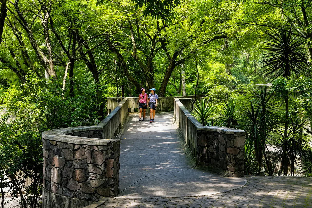
If you want to walk without leaving the city or you are just getting started, Los Colomos (between Providencia and Zapopan) is the ideal place: a large urban forest with flat, shady trails, streams, a lake and a Japanese garden. There are three loops depending on how much time you have: the short route (~3.2 km / 2 miles, 45 min), the standard loop (~4.8 km / 3 miles) and the long route (~7.9 km / 4.9 miles, +153 m). Perfect for running, going with kids or training before more serious routes, and you can walk it year-round. 📍 In the city · Difficulty: very easy · small fee. Tip: go early for a quieter visit and better light. 🗺️ Long route track on AllTrails.
📖 Related articles: The Best Parks in Guadalajara — More green spaces for walking | Things to Do in Guadalajara — A guide for your visit
Bosque La Primavera and its hot springs
Guadalajara’s green lung is a pine and oak reserve established in 1980, with dozens of entrances and a huge network of trails shared with cyclists. People say “I’m going to La Primavera” as if it were one place, but the forest offers everything from a flat two-kilometer stroll to a climb up to a mesa at 2,110 m (6,920 ft). These are the routes worth knowing by name.
5. Río Caliente and the La Primavera trails
- Río Caliente: the most famous trail leads to the hot-spring river, whose source reaches up to 80 °C (176 °F). An accessible and very photogenic walk.
- Mesa del Nejahuete: climbs from the parking area to the plateau at 2,110 m (toward Torre Dos); moderate, with some of the best views in the forest. 🗺️ Mariano Otero – Mesa el Nejahuete track on Wikiloc.
- Camino Central: the main route across the forest, ideal for combining sections and for beginners. 🗺️ Track on AllTrails.
- Cañón del Carbón and the Interpretive Trail: a path of about 2 km (1.2 miles) through several forest habitats; perfect for kids or for learning about the plants.
📍 ~30-40 min · Difficulty: very easy to moderate · Main entrance ~MXN $80 (usually includes a guide). Tip: in the driest part of the year the forest may close because of fire risk; check its status before you go and never light a fire. 🗺️ All La Primavera trails on AllTrails.
Peaks and volcanoes: hiking near Guadalajara for strong hikers
6. Cerro Viejo
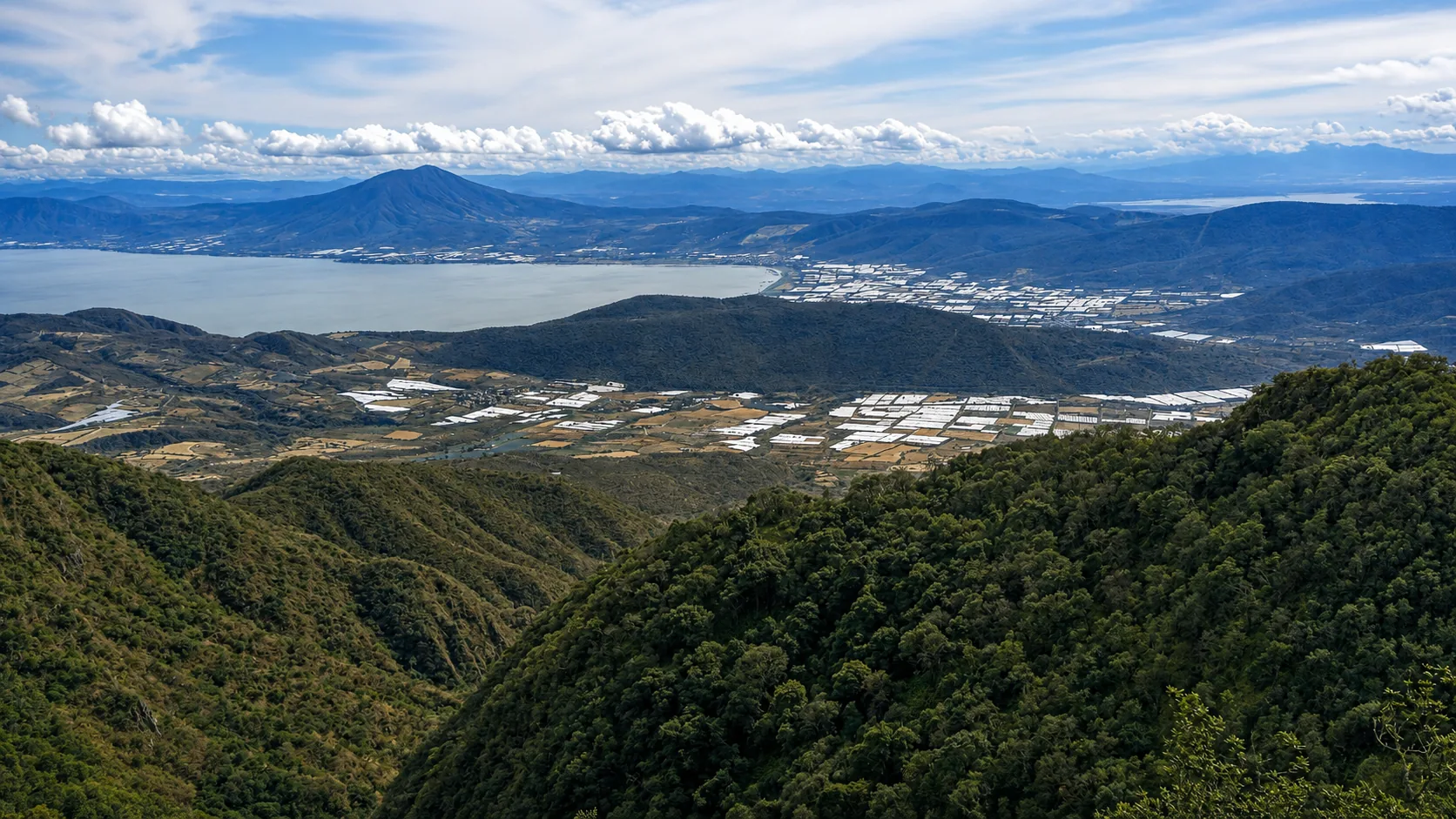
At 2,970 m (9,744 ft), it is the third-highest peak in Jalisco and the second most important protected natural area in the region after La Primavera. On the way up, the vegetation shifts from dry tropical forest to oak forest, with views of Lake Chapala. The challenge is the distance: from base to summit is about 12-14 km (7.5-8.7 miles) depending on the route. 📍 ~1 hour · Difficulty: easy at the base, very strenuous to the summit. Tip: to reach the top, leave before dawn and plan on a full day; it is ideal for camping.
- San Miguel Cuyutlán route (CFE power poles): the best known, ~12.6 km to the summit following the line of power poles; difficult. 🗺️ Track on Wikiloc.
- Jaguarundi and La Venenosa: Cerro Viejo is also the area’s mountain biking mecca. Jaguarundi (enduro, the best maintained) and La Venenosa (pure downhill) are its star trails, and the Jaguarundi line can also be hiked. 🗺️ Jaguarundi track on Wikiloc.
- Potrerillos route (via Jocotepec): the favorite of experienced hikers; about 14 km and ~1,000 m (3,280 ft) of elevation gain in 6-7 hours, high difficulty.
- Base walk (~5 km): if you are not after the summit, the base has lookouts and a cold spring with drinkable water; suitable for beginners.
7. Cerro Gordo (Los Altos de Jalisco)
To clear up a very common confusion: the real Cerro Gordo is not in Zapopan but in Los Altos de Jalisco, between Tepatitlán de Morelos and San Ignacio Cerro Gordo, an hour and a half to two hours east of the city. It is an extinct volcano at 2,667 m (8,750 ft), the highest point in the region, and summiting it is a serious route: about 13 km (8 miles) with +560 m (1,840 ft) of elevation gain and roughly 4 hours through pastures and forest, with sweeping views of Los Altos. 📍 ~1.5-2 hours · Difficulty: hard. Tip: there is little shade for much of the way; start early, bring extra water and ask the people of San Ignacio about access. 🗺️ Track on AllTrails · Cerro Gordo Integral on Wikiloc.
8. Tequila Volcano
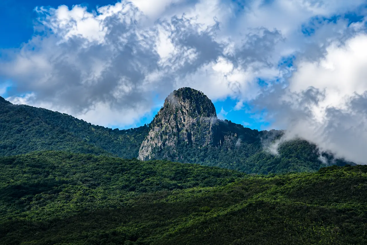
The dormant volcano that dominates the agave landscape rises to 2,920 m (9,580 ft). There are two very different ways up. The easy one is the cobblestone road (passable in a high-clearance vehicle and walkable) that crosses the forest to the top; the hard one is tackling La Tetilla, the rock peak at the summit, via the Barranca del Veinte, a very difficult route for experienced hikers only. It gets cold at the top, so bundle up. 📍 ~1.5 hours · Difficulty: moderate (road) to very difficult (La Tetilla). Tip: combine the hike with a visit to the Pueblo Mágico of Tequila (an officially designated “Magic Town”). 🗺️ Summit road track on Wikiloc · La Tetilla route (advanced).
9. Nevado de Colima
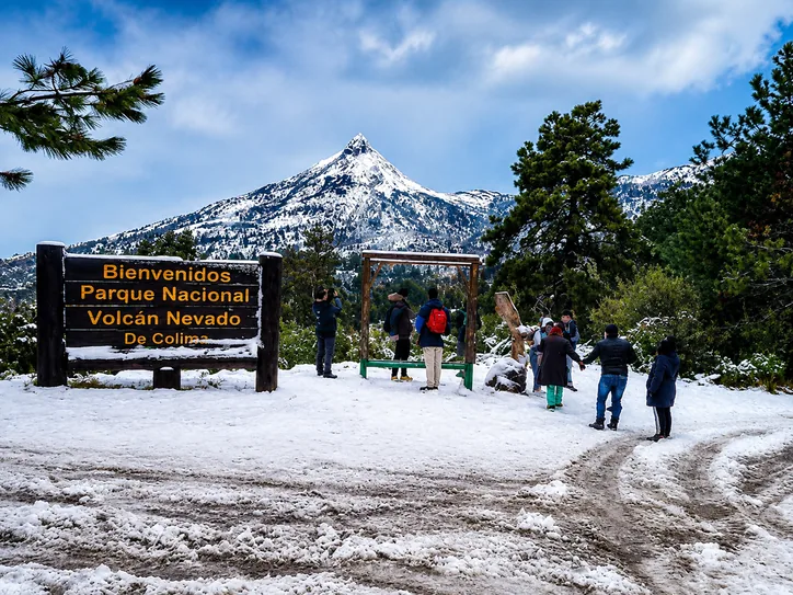
On the border between Jalisco and Colima stands one of the highest mountains in Mexico, a true high-altitude goal. From the La Joya shelter, the summit push is about 7 km (4.3 miles) round trip with steep climbs (around 4.5 hours if you are fit), while the full traverse from below can reach 23 km (14.3 miles) and +2,432 m (7,980 ft). It gets truly cold: prepare physically and bring layers. 📍 ~2.5 hours to La Joya · Difficulty: hard to very hard. Tip: acclimatize and check the weather; in winter there may be ice. 🗺️ Sendero del Tubo track on Wikiloc · full traverse.
📖 Related articles: Things to Do in Tequila, Jalisco — After you come down the volcano | Pueblos Mágicos of Jalisco — Combine hiking with a small-town visit
The Lake Chapala shore and Ajijic
The mountains that drop down to Lake Chapala offer what many consider the best hiking near Guadalajara: just over an hour away, with green trails, lake views and a very active hiking community in Ajijic. Here, too, it helps to tell the trails apart.
10. El Caracol Trail (to Mesa del Ocote)
A path known for staying green almost all year. It climbs gently up a canyon, crossing the stream, to the zigzag section (“El Caracol,” the snail) that tops out at Mesa del Ocote, an oak clearing ideal for a picnic or camping. It gains about 600 m (1,970 ft) with views over both Lake Chapala and the Laguna de Cajititlán. 📍 Ixtlahuacán/Chapala · Difficulty: moderate · suitable for beginners with good mobility. Tip: enter via the road to the Instituto Internacional and park at the “chiveros.” 🗺️ Track on AllTrails.
11. El Tépalo and La Chupinaya (Ajijic)
Ajijic’s most popular trailhead is one kilometer from the town center. The first goal is the El Tépalo waterfall (flowing in the rainy season) and the El Pandito rest stop; from there the path climbs past three white crosses and a chapel to the Cruz de La Chupinaya, the highest point of the El Travesaño range at about 2,400 m (7,870 ft), with more than 900 m (2,950 ft) of elevation gain and views of the lake, Cerro de García and, on clear days, the Nevado de Colima. For a longer scenic loop there is La Cresta–Anillo Verde (~8.7 km / 5.4 miles), which runs along the ridge through oak forest. 📍 Ajijic · Difficulty: intermediate to strenuous. Tip: start early; the upper part of the climb to La Chupinaya has no shade. 🗺️ Chupinaya – El Tépalo track on Wikiloc.
12. Cerro García (San Juan Cosalá)
For those who have already mastered La Chupinaya, Cerro de García is the next level: at about 2,750 m (9,020 ft) it is the highest point on the lakeshore, a demanding summit approached from the San Juan Cosalá side that rewards you with the best panoramas of all of Lake Chapala. 📍 San Juan Cosalá · Difficulty: strenuous · full day. Tip: this is a serious high route; go with someone who knows it or with a local guide, and bring plenty of water.
📖 Related articles: Lake Chapala — The lakeshore, its towns and what to do around it
Waterfalls and rock formations
13. Los Azules Waterfall (Tequila)
Located at the bottom of the Barranca de Tequila, this route crosses the classic blue agave fields and lush vegetation before reaching a waterfall about 70 meters (230 ft) high. It is a short loop of ~2.4 km (1.5 miles), moderate, rewarded with a pool for cooling off. 📍 ~1.5 hours · Difficulty: moderate. Tip: bring a swimsuit and go in the rainy season to see it with more flow. 🗺️ Track on AllTrails.
14. Salto del Nogal (Tapalpa)
On the way to the Pueblo Mágico of Tapalpa, the Salto del Nogal is the tallest waterfall in Jalisco (more than 100 meters / 330 ft in two drops, over a pool surrounded by rock). The hike is short but steep: about 2 km (1.2 miles), 1 to 2 hours. The area also has Las Piedrotas (the Valle de los Enigmas) and EkoPark, which even offers night hikes. 📍 ~2.5-3 hours · Difficulty: intermediate. Tip: wear shoes with good grip, as the trail down is slippery. 🗺️ Track on Wikiloc · learn more about Tapalpa Pueblo Mágico.
15. Piedras Bola (Ahualulco / Sierra de Ameca)
One of the most unusual places in Jalisco: in the forest of the Sierra de Ameca, near Ahualulco de Mercado, there are huge natural stone spheres several meters across, formed by ancient volcanic activity. The entrance is at km 14 of the Ahualulco–Ameca highway, and the climb into the forest is beginner level for anyone in decent shape. 📍 ~1.5-2 hours · Difficulty: easy to moderate. Tip: arrange access locally; the land is communally owned (ejido) and a fee is sometimes charged. 🗺️ Track on Wikiloc.
16. Sierra de Quila
This protected natural area southwest of the city is a pine and oak forest full of waterfalls and lookouts, with far fewer visitors than La Primavera. Highlights include the climb up Cerro El Huehuentón and the hikes to the El Salto de Tecolotlán (~30 m / 100 ft) and El Salto de Santa Rosa (~40 m / 130 ft) waterfalls, with campsites near the water. 📍 ~1.5-2 hours · Difficulty: moderate. Tip: register your entry with the protected area’s rangers and respect the camping zones. 🗺️ Huehuentón track on Wikiloc.
17. Cerro del Obispo (Ruta del Peregrino)
In the Ameca Valley, near Guachinango, this route is part of the historic Ruta del Peregrino (Pilgrim’s Route) to Talpa. The effort pays off at the lookout, marked by a white tower built to guide pilgrims, with wide views of the region. 📍 Guachinango · Difficulty: intermediate to strenuous. Tip: take the chance to learn about the Ruta del Peregrino, which thousands of walkers follow every year. 🗺️ Lagunillas – Cerro del Obispo track on Wikiloc.
A Pueblo Mágico getaway: Mazamitla
18. Sierra del Tigre (Cerro del Tigre, Mazamitla)
The Pueblo Mágico of Mazamitla, just over two hours away, is the perfect base for climbing Cerro del Tigre, a natural lookout at 2,800 m (9,190 ft). The classic route is an out-and-back of ~10.5 km (6.5 miles) with +506 m (1,660 ft) of elevation gain; much of it is dirt road, and the marked forest paths only appear near the top. The summit has antennas, but the views are worth every step. 📍 ~2 hours · Difficulty: intermediate. Tip: combine the hike with the town’s cabins and El Salto waterfall. 🗺️ Track on AllTrails · Wikiloc version.
📖 Keep exploring: Pueblos Mágicos of Jalisco | Lake Chapala | Best Parks in Guadalajara
Hiking near Guadalajara FAQ
What is the best place for hiking near Guadalajara?
It depends on your level: Bosque La Primavera is the most versatile and closest, the Barranca de Huentitán is the most iconic and challenging, the Lake Chapala shore (El Tépalo, La Chupinaya) has the best views, and El Diente, Trail Bugambilias or Los Colomos are ideal for beginners and families.
Where can I hike near Guadalajara for free?
For free hiking near Guadalajara, the Barranca de Huentitán costs nothing, El Diente and the Nixticuil are free if you arrive on foot, and Los Colomos charges a small fee. The main entrance to La Primavera costs about MXN $80 and includes a guide.
When is the best time to hike in Jalisco?
For hiking near Guadalajara, the best season runs from October to May, when the weather is dry. During the rainy season (June to September), waterfalls such as Los Azules, El Tépalo or the Salto del Nogal look spectacular, but canyon trails become slippery; take extra precautions.
Which app or map should I use to avoid getting lost?
AllTrails and Wikiloc are the two most used in Jalisco: download the route’s track before you leave so you have it offline. In areas with many paths, like the Nixticuil or Cerro Viejo, having the track loaded keeps you from getting lost at junctions.
What should I bring on a hike?
Hiking shoes, enough water (1.5-2 L), a cap and sunscreen, snacks, a rain poncho, ID and a charged phone with the route’s offline map.